Caution: Flows fluctuate depending on rainfall and temperature, and the gauges may not always be accurate. Refer to the daily flows to see the pattern, but don’t make your final boating decision until you’ve looked at the water.
Thanks to the California Department of Water Resources for providing web pages linked to real-time gauges for the South Fork and many other California rivers.
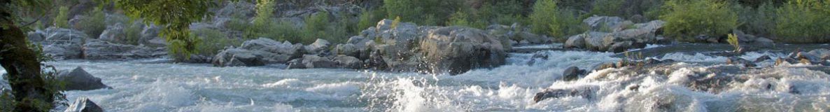
Best Real-time River Flows Information
Dreamflows – Chris Shackleton’s ultimate flows pages for western U.S. rivers. Free Dreamflows reports and alerts are available via email. Site also includes bulletin board, photos and river information.
CDEC California Real-time River Flows
CA DWR CDEC Interface – Jef Poskanzer’s simplified interface to the California Data Exchange Center (CDEC) of the California Department of Water Resources (DWR).
CDEC: Real-Time River Stages – List of all rivers reported by CDEC, with links to the latest flows.
Recreational River Flows – Mike Bean’s quick and easy flows interface.


More Flow Resources
American Whitewater: River Gauges – Links to river gauges across the United States.
USGS Real-Time Water Data for California – Daily streamflow conditions for California locations.
USGS Real-Time Water Data for the Nation – Links to current streamflow conditions across the United States.
Tuolumne River
Cherry Creek nr Mather – tabular data
Permits and water flow information – For permit and water flow information please call USFS Groveland 209-962-7825.
Planned Approximate Water Releases – The San Francisco Public Utilities Commission lists typical Monday through Saturday Flows. Data is posted during rafting season only.
Water Resources, Flows and Floods
American River Flood Frequencies – Research by Kelly T. Redmond at the Western Regional Climate Center about the American River and flooding.
American Water Resources Association – To advance multidisciplinary water resources education, management and research.
California Division of Flood Management – State of California water resource page with links to current river conditions, snowpack status, satellite images, weather forecasts, etc.
Floor Risk Management and the American River Basin: An Evaluation – Read the National Academies Press article about the U.S. Army Corps of Engineers’ (USACE) investigations of flood control options for the American River basin and evaluates flood control feasibility studies for the watershed, with attention to the contingency assumptions, hydrologic methods, and other analyses supporting the flood control options.
Improving American River Flood Frequency Analyses – National Academies site contains analyses about the Sacramento area and the confluence of the Sacramento and American Rivers.
National Weather Service California Nevada River Forecast Center
Rainfall and River information – National Weather Service monitors rainfall and flood potential for the Bay Area and Sacramento Area.
SMUD: Upper American River Project – SMUD’s Upper American River Project (UARP), consisting of 11 reservoirs and eight powerhouses, generates enough electricity to meet about 20 percent of SMUD’s customer demand. This page concerns the relicensing which is in progress, and may substantially affect flows for fish and wildlife, boaters and other stakeholders. Includes documents, meeting minutes, other information.
Water Resources of California – The U.S. Geological Survery (USGS) provides extensive background and historic data.
Water Rights – State Water Resources Control Board information about water rights in California.